On March 3, 2010, Meghan Hicks and I will set off on what the biggest adventure of my life. It won’t the be the longest run or the highest run or the cold run. Heck, it won’t be a run at all. Stay with me here. Instead, we’ll be attempting to cross a big chunk Yosemite National Park primarily on snowshoes. Below, I’ll tell you why we want to snowshoe across Yosemite, how preparation has gone, and basic details about the trip. Stop back in tomorrow if you’d like to learn what gear I’ll be using.
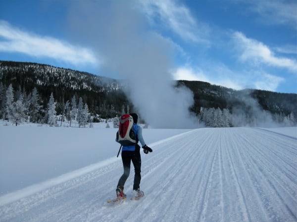
In January 2009, Meghan and I snowshoed across Yellowstone National Park from West Yellowstone to Mammoth Hot Springs. I’d never even seen someone snowshoe prior to this trip, but still had blast. We traveled 50 miles over groomed snow-covered roads in less than 48 hours. I’ve always intended to recount this story of this amazing trip, but it looks like that day will never come. The fact that it planted the seed for this year’s trip should be evidence enough of how much I enjoyed the experience.
Fast forward to June when I moved to the Sierra foothills an hour west of Yosemite Valley. Both times I drove cross country during the move I made sure to take the slower route that weaves through the park’s Sierra high country. I was struck by its scale. A vast scale that teased an ultrarunner to try and cross it. I’ve still yet to cross the park on foot, but it would be a rather ordinary day-long feat when I’m fit and the trails are clear.
Crossing the park on foot in winter is a whole nother deal. It’s not terribly uncommon for folks to Nordic ski across Yosemite National Park. Maybe 20 or 30 folks do it in an average winter. However, I’ve yet to learn of anyone snowshoeing across the park even though it’s surely been done. Still, even the shortest route I’ve envisioned is over 40 miles and would take 3 days or more. There are no groomed trail. There are no broken paths.
Truth be told, I didn’t need to be living in the shadow of the Sierras to start emailing my industry contacts about the possible trip. I did that as soon as I knew I was moving out here. The shear challenge of this undertaking was too much for me not to keep daydreaming about snowshoeing across the park. While I certainly talked to folks about the trip over the summer, I was never sure that it was going to happen. In October 2009, I finally went so far as to pitch the idea to some of my friends. Amazingly, a few bit. The trip was on. Sadly, a few last minute commitments came up and those friends can’t join us, but they were key motivation in getting this trip off the ground.
The Preparation
Fortunately, Meghan has been there dreaming the dream with me all along. She’s an educator in the park and may be one of the rare people who dreams of the high country more that I do. As I noted earlier, she and I crossed Yellowstone on snowshoes last winter. Since that trip is off the map, as it were, the least I can do is publish these photos of the TransYellowstone Snowshoe trip.
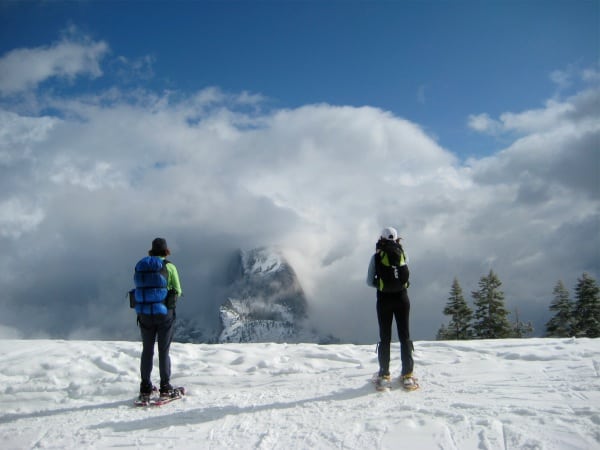
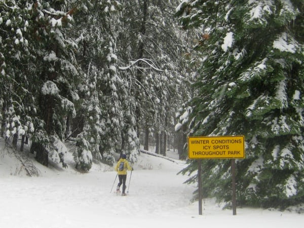
Two weeks ago, Meghan and I were joined by our friend Gretchen of Truckee for three days of snowshoeing in Yosemite. This was a good general test for TransYosemite although we were able to pack a bit lighter as our trial trip was hut-to-hut. The first day we traveled from Badger Pass ski area over to the Ostrander ski hut. On day two, we headed north to the Glacier Point ski hut with its awesome view of Yosemite Valley, Half Dome, and the high country beyond. Day three saw us return to Badger Pass. Each day was a bit over 10 miles. I walked every step and threw in off trail travel from time-to-time for training. Here are some pictures of our hut-to-hut trip.

The view of Half Dome from Glacier Point was worth 20 miles of snowshoeing and a 20 minute wait for the clouds to clear!
The TransYosemite Snowshoe Trek
TransYosemite will not be bound by the strict notion of a full boundary-to-boundary crossing. Our original conceived route was to start in Yosemite Valley, cross the Sierras at Tioga Pass, and end in Lee Vining. Unfortunately, we’re in the midst of receiving a storm with significant high country snow every three days. The avalanche danger is far to high to risk descending Lee Vining Canyon… or really even venturing deep in to Yosemite’s high country. On to Plan B!
Not ones to easily concede defeat, we’ve thrown together a new plan. We’ll cross Yosemite from North to South! We’re now planning on starting in the area of the Hetch Hetchy and the reservoir that took its name. From there we’ll head south-southeast toward Tamarack Flat before descending into Yosemite Valley. We’ll ascend and wrap around the south rim via the Inspiration Point Trail before turning south and crossing Westfall Meadows to the east of Badger Pass. We’ll then make a long slow descent to the town of Wawona. That route comes in at 55 map miles.
We’re considering adding over 10 miles to the start in order to start out side the northwest border and more importantly to pass the supposedly gorgeous Lake Eleanor. In the unlikely event that we’re feeling energetic after the trip, we’ll consider extending our trip a bit further southward to end with a visit to the Mariposa Grove of Giant Sequoias.
There are certainly disadvantages to this route. First, we don’t get to cross the Sierras. Second, we’ll certainly have to do a significant amount of dry ground hiking. While there are dangerous amounts of snow up high, much of our route will be low enough that it’ll be snow free.
On the other hand, the adventure will be more difficult in many respects. For instance, we’ll have to do a ton of route finding on terrain we’ve never seen. Where there is snow, the trails will be unidentifiable. In addition, we’ll have no choice but to winter tent camp throughout the trip whereas our west to east route had us in huts two nights. Finally, we won’t be foolishly risking our lives or the lives of those who might come look for us. This final point outweighs everything else.
Questions/Comments
So what do you think?


