[Editor’s Note: The Mosquito Fire is a volatile situation, and changes can and will occur quickly. We’ll keep updating this article as information is released via the official channels of CAL FIRE and InciWeb. This article was last updated on Saturday, September 17, at 4 p.m. Pacific Daylight Time.]
The Mosquito Fire continues to spread in California this week, threatening more than 9,000 homes and forcing the evacuation of more than 11,000 people, officials said.
While cooler weather has slightly reduced the fire’s spread the last couple of days, it continues to burn and has consumed some 71,200-plus acres of the Tahoe National Forest, InciWeb reported on Saturday morning. The blaze began about 60 miles northeast of Sacramento and four miles east of Foresthill on September 6.
With southwest winds forecasted, CAL FIRE predicted that fire’s increase in spread on Monday evening, SF Gate reported.
“The past day and a half or so, the fire just kind of sat,” Jonathan Pangburn, a fire behavior analyst with CAL FIRE, said on Sunday. “We had stagnant air and we all got to suffer with the consequences of the smoke settling in the basin … The wind will primarily still be coming out of the southwest pushing toward the northeast … It will be strong enough to move the smoke out and breathe new life into the fire.”
On Tuesday evening, InciWeb wrote, “This afternoon, a spot fire jumped the Middle Fork of the American River on the west corner of the fire’s perimeter in the Pond Creek Drainage. Due to the critically dry fuels, steep terrain, and increased ventilation, the spot fire grew rapidly towards the community of Foresthill. Firefighters and resources from around the fire have been diverted to assist with holding this corner of the fire at the contingency lines that have been put in place by crews over the past week below the community. Firefighters and a large aircraft contingency, including both fixed and rotor wing aircraft, have been engaging in active structure defense, defensive firing operations, and working to hold the advancing spot fire at control lines and protect the surrounding communities.”
InciWeb also reported increased activity on Tuesday afternoon on the fire’s north perimeter, requiring more evacuations.
On Wednesday morning it was reported that, “Overnight, firefighters successfully held the fire within control lines along the southern edge of Foresthill and Todd Valley. On the northwest corner, crews were able to continue strategic firing operations along control lines from the Foresthill Divide Road to Deadwood Road. This four-mile stretch of line is crucial for helping hook and stop the fire’s northern spread.”
As of Saturday, September 17, 21% of the fire has been contained, but the impact of the fire continues to be devastating.

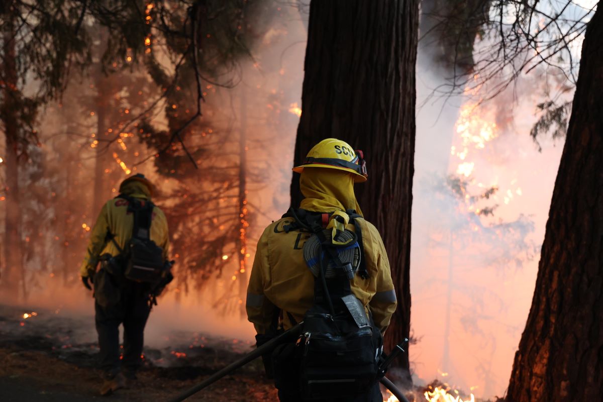
Firefighters tackle the Mosquito Fire, which has forced more than 11,000 people to evacuate from their homes in the Sierra Nevada foothills of California, around the small town of Foresthill. Photo courtesy of CAL FIRE.
Blaze Impacts Western States 100 Route
Organizers of the Western States 100 continue to monitor the Mosquito Fire, which has already impacted parts of the historic Western States Trail, the trail upon which the race travels.
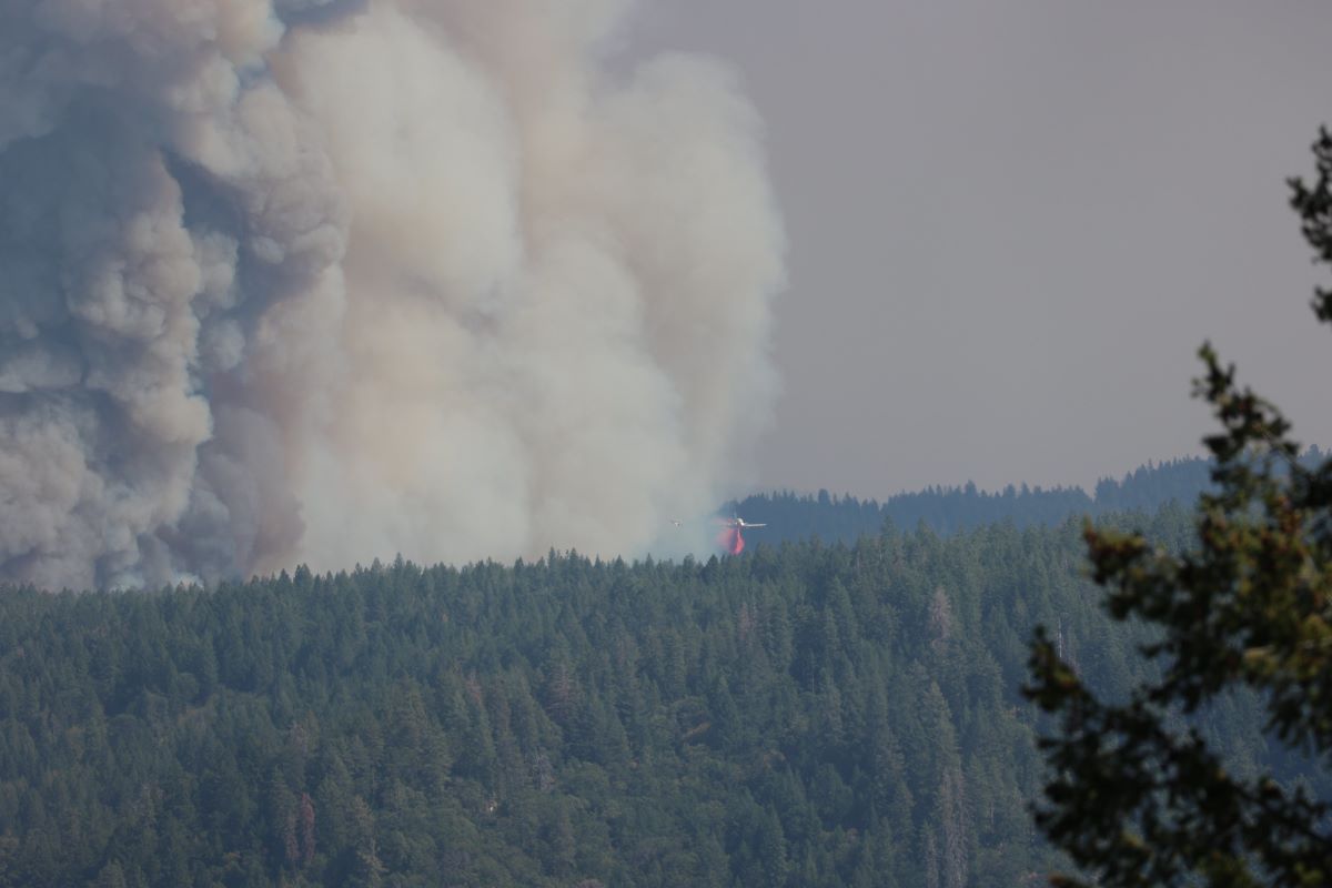
The wildfire has begun “creating its own weather,” with a massive, 40,000-foot-tall plume called a pyrocumulus cloud. Last week, Western States 100 race director Craig Thornley posted a photo of the cloud looming over downtown Auburn — the traditional end of the 100-mile course.
Late last week, the fire burned through the village of Michigan Bluff, located a few miles northeast of Foresthill, and what hosts the mile 55 aid station of the event, tragically consuming a number of homes in the process. On Tuesday of this week, the fire pushed toward the outer reaches of Foresthill and its neighbor to the southwest, Todd Valley, causing the damage to and loss of more structures. To date, some 91 structures have been destroyed or damaged by the Mosquito Fire.
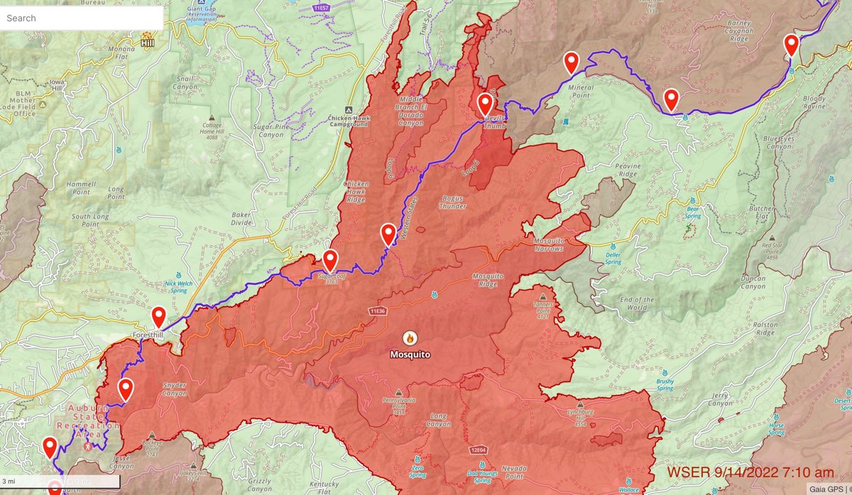
The race organization has been sharing updated maps like a recent one below showing the footprint of the fire and where it encroaches on the Western States Trail. As of Saturday, the Western States Trail appears affected from the area of the Devil’s Thumb aid station, which is about mile 48 of the race course, through around the Cal 1 aid station, which is about mile 66.

A map showing the area of the spread of the Mosquito Fire relative to the Western States Trail, as of Wednesday, September 14, 2022. The Western States Trail is the blue line, the largest area of red shading is the perimeter of the Mosquito Fire, the lightest red shading is the perimeter of the 2013 American Fire, and the darkest red shading is where the two fire boundaries now overlap. The Western States 100 travels on the Western States Trail from east to west, or from right to left in this graphic. Image courtesy of Craig Thornley/Western States 100.
iRunFar spoke with Thornley on Tuesday, September 13, who made it clear that the welfare of the residents and their homes was still the top concern, and would continue to be before any damage to the trail would be looked at or quantified. He said:
“Our biggest concern has been, and still is, the people whose lives and whose homes are in jeopardy. There are still 11,000 people evacuated. So it feels a little premature still to talk too much about the effect on the trail.”
In the context of trail damage, Thornley pointed out that the fire won’t necessarily have destroyed everything in its path, and that the extent of the damage to the affected areas won’t really be known until after the fire is contained and the trail is inspected.
Visit CAL FIRE and InciWeb for daily updates on the Mosquito Fire, and the progress in fighting it.
No matter what happens, it’s likely that wildfire impacts on trail racing have become a “new permanent reality,” as iRunFar Editor-in-Chief Bryon Powell wrote earlier in 2022.
However, the Western States 100 has risen from a similar story, through its rehabilitation of the Western States Trail following the 2013 American Fire. That rehabilitation was movingly chronicled on iRunFar by Western States 100 board member John Trent.


