With each footfall, breath, and tick of my watch, I feel curiosity stirring inside of me. This feeling only intensifies, so I search the crevices of my mind for the source of intrigue. All the while, I try to keep focus on navigating by the two-by-six-inch white blazes that mark the oldest long-distance hiking trail in the United States. The creation of this trail that runs the length of the state began when the Green Mountain Club declared a mission to make the mountains of Vermont play a larger part in the life of the people. Speaking for myself alone, I can say they have succeeded.
I have digressed, let me backtrack. For countless years, I have wanted to summit Camel’s Hump and then follow the Long Trail north for 30 miles to the summit of the highest peak in Vermont, Mount Mansfield. Two distinctive mountains, similar in size, both rock capped, but at the same time the two mountains vastly differ in their development and personalities. The Hump sits amongst a forest preserve, while Mansfield is one of the most highly developed mountains in the state. I have summited both mountains countless times, but never in the same day nor during the same run. Increasingly, I have been reminded that life is short, life is unpredictable, and dreams will only be dreams until I transform them into reality. So with my hydration pack filled with essentials for the day I park my car in Huntington at the base of Camel’s Hump and head up the trail.
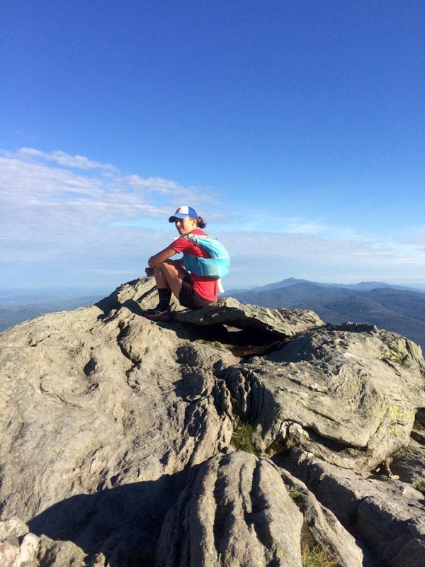
Within an hour I summit Camel’s Hump. Being the only soul on the summit feels spectacular. Rather than tagging the summit and taking off, I decide to sit and take in the sights and sounds. From this stony pedestal I have a panoramic view. To the west is Lake Champlain and the New York Adirondacks, to the east are the White Mountains, and then dominating the immediate landscape to the north is my destination, Mount Mansfield. I feel alone, isolated with my thoughts and surrounded by the sound of a gentle wind. Through my adventures I have come to learn that feeling alone can be unsettling, but in this moment it feels extremely empowering. After getting lost in my thoughts I get back on my feet with the realization that I’ve got a lot of distance to cover.

On the summit of Camel’s Hump. All photos courtesy Aliza Lapierre.
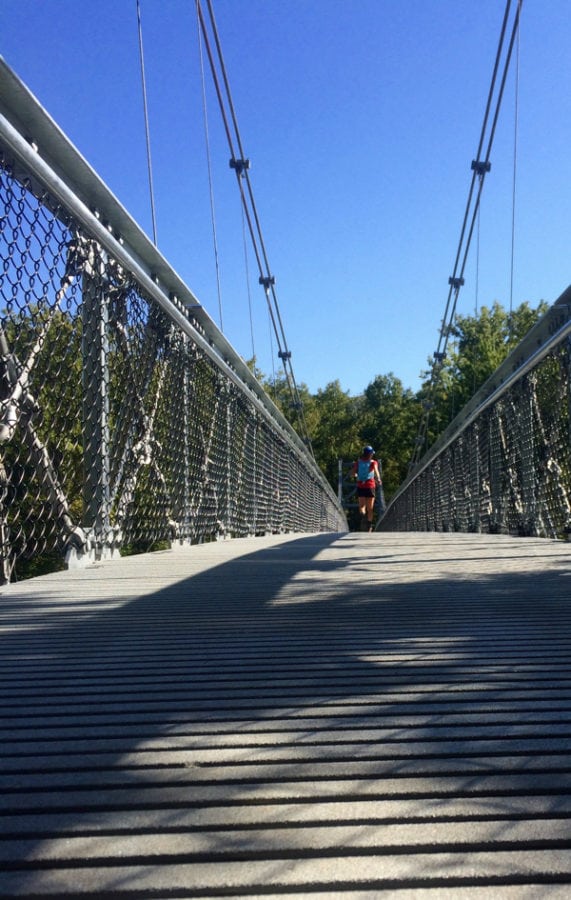
After descending Bamforth Ridge via the Long Trail, I follow the Winooski River and then cross the newly installed foot suspension bridge. North- and south-bound traffic surges past on Interstate 89 and Route 2. Ah civilization, I haven’t really missed you, but this intersection provides me with the opportunity to refill my hydration pack. Earlier this morning, my stepfather Jeff left me water at the Bolton trailhead. As I run up to the parking lot, I find the 20-year-old Igloo family cooler locked to the trail kiosk with my name written on it. Certainly worth a laugh as it seems like high security for a gallon of water, but damn it is good and cold.
After filling my hydration bladder and offering the remaining water to other hikers, I am off. Not even three hours into my endeavor and I have over 12 miles under my belt. Yes that does sound slow, but on these trails nothing happens fast, besides falling. I feel good, am making progress with ease, and develop what I will understand in retrospect as a false sense of confidence as I am now at the lowest elevation of the Long Trail so there is nowhere to go but up! I climb up the road section and then plunge back into the woods, running the rollers and flats. After a few miles, the dryness and sun catches up with me. The Long Trail is notorious for its mud and boggy sections, slick rocks, and streams, but with no rain this summer, everything is bone dry. With each moment it becomes increasingly clear that I will have to ration my water over the next six-plus hours.

Crossing the new bridge on the low point of the Long Trail.
Over the next miles, I sip water only when taking in calories, then finally I come across a section that has some moisture in the form of a few stagnant puddles cupped in the rock. I pull my Lifestraw out of my pack and examine the puddle from my knees. I can see organisms milling about, but with fingers crossed I begin gulping through the straw. I drink almost the entire puddle, before moving up rock to the next minute pool. Five hours into my endeavor I am now in the thick of the wilderness, committed to forward progress. False summit after false summit I make my way to the top of Bolton Mountain. It honestly feels like it takes forever because I am starting to obsess over the time of day. Just below the high point of Bolton Mountain, from the Puffer Shelter, I send my mother a text. She is tracking my day and at the culmination she is my ride home. I can’t tell if the text goes through or not before shoving my phone back in my pack, but feel like I don’t have time to fuss about it.
I descend into Nebraska Notch and my hope is to make up some time on this section, but the rocky ledges laden with roots and the wooden ladders installed to aid in maneuvering over the technical terrain don’t help. I catch my toe and fly forward, luckily getting my feet back underneath my body before I hit the ground below. My heart races and now being alone feels different. Fear of getting hurt in the solitude of these mountains resonates in my mind. I check my phone and see a text from my mom that she is out on the trail headed toward me with water and snacks to help me refuel before the final push to the summit on Mansfield. I think about her text, which is fairly vague, as she could be within yelling distance or still miles away. After dropping about 2,000 feet and passing Taylor Lodge I see a skittish wild-looking dog standing in the trail and holler “Shotgun.” It’s my mother’s dog who has wandered ahead of her to find me. Further up the trail I see my mom sitting on a rock, waiting for my arrival. We sit on the trail as I chug a bottle of cold water she has carried in. Then from her pack she pulls out a bag of salt-and-pepper potato chips and we work on eating those. I can’t consume them at a fast-enough rate to appease my appetite.
As we sit and talk, reality sets in. I still have about 10 more miles in front of me. Ten miles doesn’t sound like a lot, but there have been sections where traveling even two miles an hour is labor intensive. My mom and I start hiking north together until we reach an intersection where I can continue on the Long Trail or head to the car–also known as bailing! I keep right, staying on the Long Trail reiterating aloud to my mother, but more to myself, that the point is to summit both mountains. My mom heads back down the trail to the car and will meet me down the next valley after I make my final summit of the day. Within minutes of leaving her, I start to second guess my decision to continue. My energy is waning, my teeth feel like they have layer upon layers of plaque, and everything I touch feels sticky. In the scheme of things I am fine, just transitioning into the realm of uncomfortable. I scurry up the ladders and cling to the rocks on the ledges, all the while trying to keep an honest pace and focus.

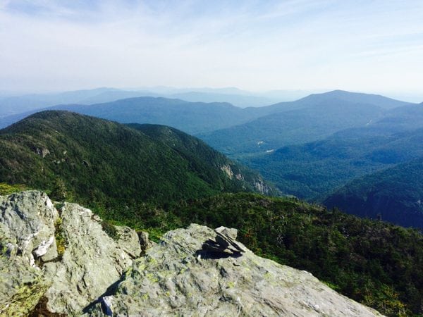
Looking back at Camel’s Hump while approaching Mount Mansfield.
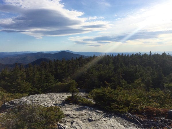
As the sun starts to noticeably lower I am almost to the ‘forehead’ of Mansfield and from here I traverse across the bare summit ridge that extends for more than a mile to the ‘chin’ before taking the most direct route down. With broad views, I make my way across ledges and stone. I am taunted by the looming darkness so I don’t look at the views too much. I try to make quick work over to the chin, but the trail becomes more congested as it is occupied by people mostly dressed in street wear carrying little to nothing beyond their SLR cameras. This is the reality of a developed mountain, where you can drive to the top or ride the gondola up to just below the summit. I try to be polite, letting them know I am approaching while also saying hello.
A man walking south asks, “Where are you going in such a hurry?” I semi-begrudgingly slow to a stop and see him wince as he glances at my lower legs, which are crusted over with several layers of mud. Then again maybe it is my outdoorsy odor that makes him grimace. As I stumble for words to explain the journey I am on, I peer down at my GU- and chocolate-bar-stained shirt and feel that my appearance is being judged. Immediately a feeling of self-consciousness comes over me and I tip my trucker cap and swipe my forehead with the buff that is wrapped around my wrist. The breeze flutters my running shorts as wisps of my dark brown hair ‘dance’ around my face. There is really no use in trying to tidy myself up to appease this gentlemen as I attempt to hurriedly verbalize where I have been and where I have yet to go. He has no idea what I have accomplished, but that is okay with me. It is my bucket-list adventure, my dream, and I’m not going to allow a well-dressed man wearing loafers on the top of a mountain make me feel inadequate.
Finally, I reach the high point of the ridge and turn off the Long Trail to head down toward Underhill State Park, but as I turn there is hesitation. The curiosity is there, asking question after question. How much further I could go following those two-by-six-inch blazes? What are my limits? Why does this trail that I seem to love and hate bring me such intrigue? I have fulfilled my dream of summiting both mountains in the same effort, yet in the process I have also created many more pipeline dreams for myself and this 273-mile trail from Massachusetts to Canada.
Call for Comments (from Meghan)
- What non-race adventures are on your personal ‘bucket list?’
- Do you have any close-to-home routes you’d like to run in a day? And how about an adventure further afield?

Reaching the Mount Mansfield summit.
